Person in the Spotlight: Mario Cimino, Executive Director of the Pennsylvania Resources Council

2017 MLC PRC Pic

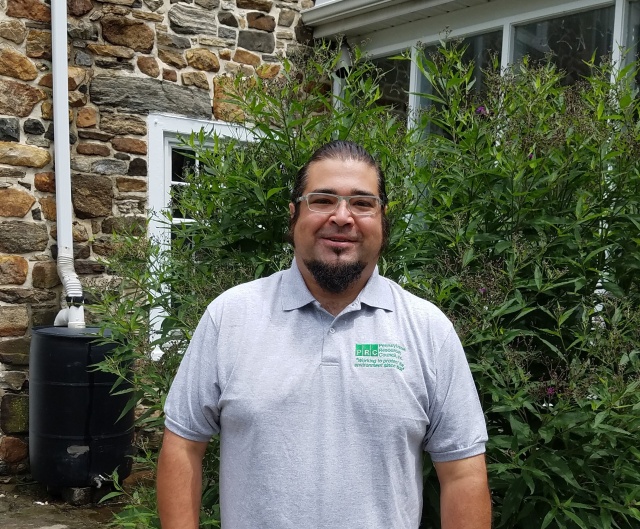
Mario Cimino, Regional Director of the Pennsylvania Resources Council’s East Office and Morton Borough’s Council President. (SOURCE: Pennsylvania Resources Council)

Upstream/Downstream spoke with Mario Cimino, Regional Director of the Pennsylvania Resources Center’s East Office, who was kind enough to share his experience working at the Pennsylvania Resources Council and explain some of the organization’s priorities and recent initiatives. Mario also spoke about his work with the Upstream Suburban Philadelphia Cluster, and what it’s like to be Morton Borough’s Council President.

How Did You Get Involved at the Pennsylvania Resources Council? What Brought You There?

A combination of academic, professional, and life experiences brought me to the Pennsylvania Resources Council (PRC). I did my undergraduate degree in Environmental Studies at Susquehanna University, which I’d like to recognize here as having the oldest Environmental Studies program in the country! Since then I’ve specialized in stormwater management in my professional career.

After I graduated I worked in Environmental Consulting for a few years, and then got involved with several political campaigns. From there I transitioned to working in non-profit organizations, and finally I ended up at PRC. Every step of the way, I’ve made sure to keep my concern for the environment—and stormwater management in particular—at the forefront of my decision-making.

What are Your Primary Interests or Concerns Regarding the Environment, and Especially Stormwater, in Southeastern Pennsylvania?

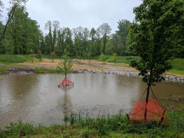
I view stormwater issues in Southeastern Pennsylvania through two main angles. First, there’s the fact that many of the environmental rules and regulations that come down from the Federal Government through the Environmental Protection Agency (US EPA) are unfunded mandates that are hard for small, cash-strapped boroughs in the region to uphold. Second, but tied to the first issue, is the problem of educating the public about stormwater. It can be tough to get people excited about stormwater, especially when they can’t see the effects of environmental degradation in their local streams.

That said, the local level—counties and municipalities—has far more potential than the national or state level to make a positive impact on environmental issues relating to stormwater. Watershed health, for example, could be greatly increased by banding municipalities together to work on reducing pollution at the regional level.

However, the local level is chronically underfunded, and with the recent change in leadership at the US EPA it looks like federal funding for issues like stormwater management will dry up even more. I’m confident that organizations like the William Penn Foundation and the National Fish and Wildlife Foundation will remain steady streams of funding for stormwater management issues in Southeastern Pennsylvania. That said, less federal funding for stormwater management in the future will result in fewer green stormwater infrastructure (GSI) projects in the region.

Costs for GSI projects and stormwater system upgrades are rising, and the local level is always the hardest hit by these increased price tags. In the 1970s, when municipalities across the country were struggling to deal with their aging sanitary sewers, the federal government released a substantial amount of money in cheap loans and block grants to municipalities to make these much-needed upgrades. Now, though, there is little similar funding available.

Ultimately, it comes down to educating the public. An informed public can reduce the financial strain on municipalities to meet federal environmental regulations, as the residential sector is one of the biggest contributors to stormwater management issues at the local level. Even things as simple as holding public workshops to teach homeowners how to install rain barrels on their property can make a huge difference.

Can You Explain a Bit About the Work That the Pennsylvania Resources Council Does in the Region? What Role Do You Play at the Pennsylvania Resources Council?

I am the Regional Director for the Pennsylvania Resources Council’s East Office (meaning Eastern Pennsylvania, there’s another PRC office in Western Pennsylvania). That means I run daily operations, manage project staff, manage the Environmental Living Demonstration Center in Ridley Creek State Park, and look for money and funding for PRC.

Due to my academic background in environmental studies and my work over the years in stormwater management, I also do a lot of work with various members of the Delaware River Watershed Initiative (DRWI), and I collaborate with local and regional stakeholders—including a broad cross section of government officials, businesses, and other organizations—to identify opportunities and share information on stormwater in Southeastern Pennsylvania. As a group, we work to educate the public through educational workshops, outreach events, and online through social media outlets.

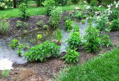
Examples of this collaborative approach are the numerous GSI demonstration projects we are installing in high-visibility public locations, such as municipal buildings, around Southeastern Pennsylvania.  These projects bring together municipal officials, residents, local businesses, and community organizations to spread the word about simple, inexpensive strategies for managing stormwater and improving water quality in our streams.

IMG_1678

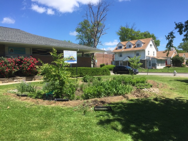
Example of a GSI project in front Yeadon Borough’s public library. (SOURCE: Mario Cimino, Pennsylvania Resources Council)


Does Any of PRC’s Work Overlap with the Goals and Initiatives of the Upstream Suburban Philadelphia Cluster (USPC) or Morton Borough? If It Does, How So?

I often have to be careful about which hat I’m wearing so that I don’t get my priorities as Regional Director of PRC’s East Office confused with my role in the USPC and Morton Borough’s Council President. I always recuse myself when conflicts of interest arise between the aims of my various positions, but I also try to ensure they work in tandem with each other.

For example, in my role at PRC, I often collaborate with DRWI on Darby/Cobbs Creek watershed initiatives. Also, since Morton Borough is in the Eastern Delaware Watershed I see firsthand how my work on water quality in Southeastern Pennsylvania is benefitting people at the local level in my own Borough and others around it.

As Morton Borough’s Council President, I’ve been trying for the past few years to drum up interest in stormwater so that, when I leave my role at the Borough, whoever takes my place carries on my legacy of dealing responsibly with stormwater issues.

Seeing watershed management issues from these varied perspectives offers me a unique vantage point.  This vantage point has taught me that improving our environment provides important benefits to the health and quality of life in our communities, but that the cost of these improvements poses financial hardships as well.  Typically, due to patterns of development in urban and suburban areas, communities with fewer financial resources tend to face greater environmental challenges.  For this reason, it is neither feasible nor fair to expect the neediest communities to deal with environmental issues on their own.  Equitable access to the resources such communities need can only come from broad-based support at the state and federal levels.

As an Elected Official, can you Speak About Some of the Challenges Facing Municipalities in Southeastern Pennsylvania Relating to Water Quality and Stormwater Management?

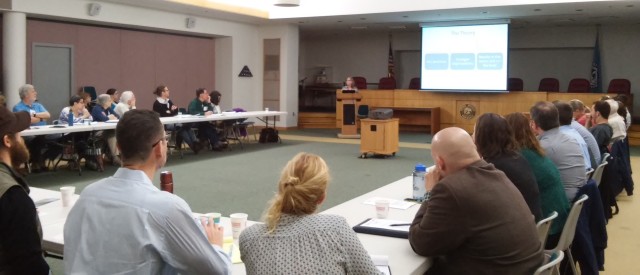
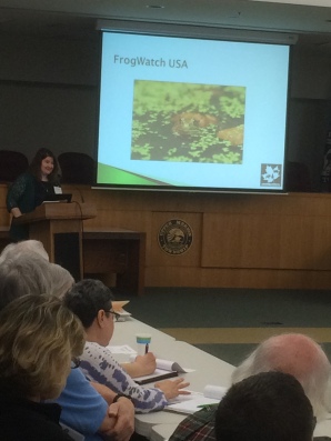
A big priority at DRWI, and at PRC as well, is educating the public about the importance of stormwater management to water quality. PRC’s mantra is that, by educating children about stormwater and water quality, they will educate their friends and parents and grow up to be stewards of their local streams and waterbodies.

Rain Garden Educational Sign FINAL

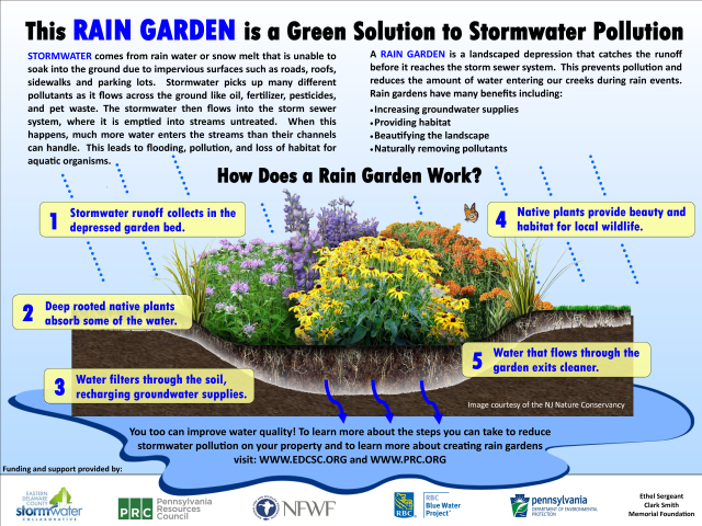
One of PRC’s educational brochures on rain gardens. (SOURCE: Pennsylvania Resources Council)


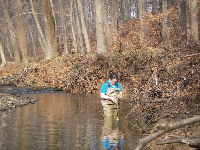
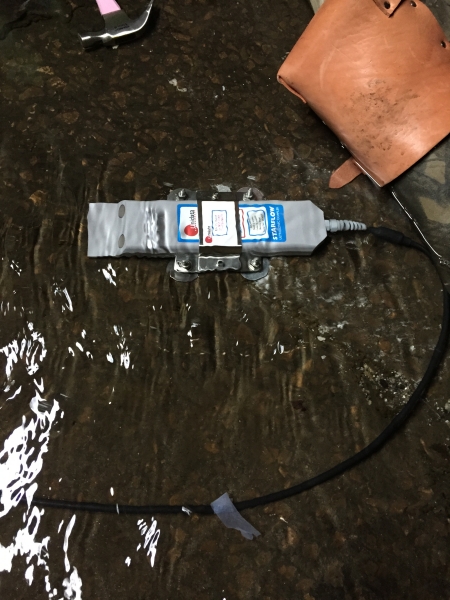
PRC’s marquee public outreach and education program, which is aimed at children in public schools, is called “Stream Stewards.” Through this program, we get into local public schools and teach kids basic river biology and chemistry. To get the kids to connect what they’ve learned to the real world, we take them on field trips to local streams and have them look for some of the macroinvertebrates we taught them about in the classroom. Stream Stewards is a very popular program, and most of the kids we reach really seem to enjoy it!

20161006_102026

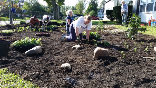
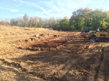
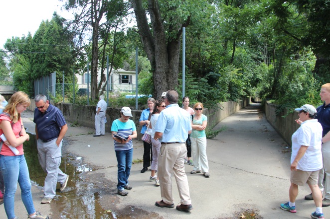
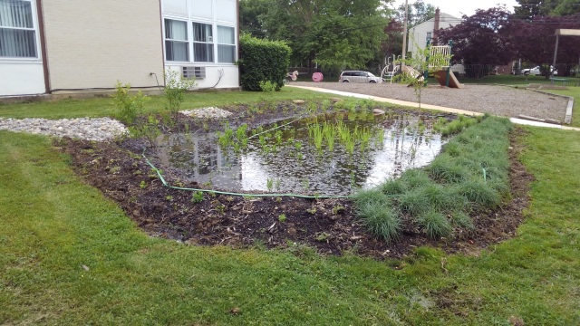
Engaging the public in GSI upgrades is a major way to increase public knowledge about stormwater runoff and its impact on water quality. (SOURCE: Mario Cimino)


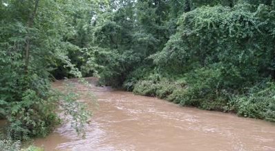
On a less positive note, the average person doesn’t know what a clean or a dirty stream looks like anymore. Since the 1970s and 1980s, we’ve done a great job in this country of getting rid of visible pollution, like illegal dumping and chemical spills, in our streams and rivers. While this is a good thing, it also makes it hard to get people excited about cleaning up their streams and rivers because, if they can’t see the pollution, why would they care about cleaning it up? For example, the Darby/Cobbs Creek watershed is much more polluted than the Ridley Creek watershed, but if you were to take the average person to a stream in each of these watersheds, they probably wouldn’t be able to tell you which was in better shape.

KIMG0048

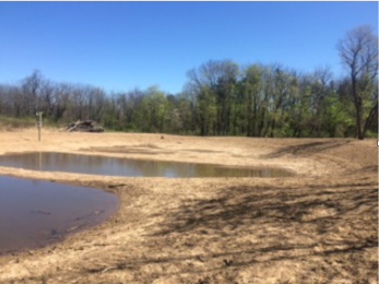
Teamwork makes the dream work. (SOURCE: Mario Cimino)


How Do You See Other Municipalities in the Region Dealing with these Issues?

One major way municipalities in Southeastern Pennsylvania are dealing with stormwater issues is through the (EDCSC). The Collaborative was started by six municipalities a few years back, but now it’s up to ten. The original six municipalities formed the EDCSC to get a jump on stormwater issues in their area before they got too bad, and figured it would be more economical to share the costs of stormwater upgrades, repairs, and GSI installations. Also, since water quality is a regional issue, they thought it made sense to attempt to deal with it regionally. The York County Stormwater Collaborative has worked well and had many positive effects on stormwater management in that area, and in my experience (as well as most scientists’), dealing with something like stormwater on an individual basis simply does not work.

On the flipside, other municipalities are burying their heads in the sand when it comes to managing stormwater. A lot of the current elected officials in the region are refusing to do anything about stormwater because they know that they won’t be in office by the time real problems crop up.

Can You Talk a Bit About Some of the Other Hats You Wear?

In addition to my three main roles, I also work with and volunteer for a few local organizations on stormwater and other issues of environmental concern, but my main side hobby is Historic Preservation. One of the main Historic Preservation efforts I’ve been involved with over the past year or so that I’d like to give a shout out to here is called “Save Marple Greenspace.”

The effort concerns the 213-acre Don Guanella forest, one of the last remaining shreds of “Penn’s Woods” in eastern Delaware County. Given the runaway development in Delaware County over the last 20 – 30 years and the county’s ranking as having one of the poorest air quality indexes of any county in the United States, saving the forest from development serves the dual role of providing much needed green space to local residents and as a buffer against doing further harm to the area’s air quality.

The land is currently owned by an Archdiocese that relies on local, county, and state taxpayers to cover some of their share of the bill. To circumvent what they saw as a burden on local taxpayers, Marple’s elected officials sought to broker a deal between the Archdiocese and a real estate company that wanted to overdevelop the land. So far, “Save Marple Greenspace” has successfully advocated for the area and development plans are off the table, but the land isn’t out of the woods yet. I look forward to continuing this fight and hope we’re successful in keeping the Archdiocese’s land safe from development!

Article by Zhenya Nalywayko, based on an interview with Mario Cimino. Photographs courtesy of Mario Cimino.

Posted in Partners | Leave a comment

Update: Bright Future for the Village Circle Stormwater Basin in Whitpain, PA

In 2007, the Philadelphia Water Department conducted an inventory of stormwater basins in the Wissahickon Watershed and found, evaluated, and ranked 153 basins.  The survey determined that most of the basins were designed to capture and hold large amounts of water during major rain events and then slowly release the water into the nearest stream.  However, major rain events, over 2” in 24 hours, represent less than 20% of annual rainfall as compared to minor rain events, which are typically under 2”.  Most stormwater basins in the region were not designed to capture and hold smaller amounts of rain water. Instead, water from minor rain events flows directly through such basins, leading to erosion, pollution, and sedimentation downstream.

In recent years, there has been a renewed interest in how existing stormwater basins detain stormwater on-site. Basins can be re-designed (or “retrofitted”) to retain/infiltrate runoff from smaller storms by replacing the basin’s mown grass with deep-rooted native plants, redesigning the angle of the basin’s sides, and making the outflow pipe smaller. Such retrofits slow the flow of water through the basin, allowing it to soak into the soil.  These practices are typically referred to as naturalizing stormwater basins.

Whitpain Township, a municipality in Montgomery County roughly 20 minutes from Philadelphia, offers an excellent example of a successful stormwater basin retrofit. In 2009, Whitpain began working with the Wissahickon Valley Watershed Association (WVWA) on a re-design of a stormwater basin it owns in the Village Circle subdivision, originally constructed in the 1970s. The Township hopes the re-designed basin will serve as a model for other municipalities in the region as their storm sewer systems age, climate change brings major storms more frequently, and they must comply with stricter stormwater control requirements.

Whitpain first worked with WVWA and the Pennsylvania Environmental Council to create a retrofit design using funding from the Schuylkill River Restoration Fund.  The Township issued a request for bids for the retrofit construction, but rejected every proposal due to their high costs.  More information was needed on current design conditions and future maintenance costs.  Whitpain subsequently withdrew its request for bids.

While Whitpain re-evaluated its plan for the Village Circle basin, it naturalized two other basins and applied the lessons learned from those projects to their new proposal. In 2015, Whitpain released a new request for bids with more specific measurements of the basin, a less diverse planting regimen, and less stringent operations and maintenance requirements. The bidding process was competitive, but Whitpain eventually chose Land Concepts LLC to lead the redesign.

Land Concepts first conducted an updated survey of the Village Circle basin to understand how much regrading would be required.  As part of this survey, Whitpain Township staff helped to dig 6- to 8-feet down in several spots around the basin to see what was underneath the topsoil (it turned out to be dry sandstone, meaning they could re-design for infiltration). The basin design includes a meandering flow path through the basin, infiltration beds (which detain stormwater long enough to allow it to infiltrate into the soil), and a modified outlet structure. Land Concepts also added a forebay—which also retains stormwater and allows it to infiltrate before it reaches the outflow point—and hardy native vegetation to their retrofit plan. Finally, Land Concepts hired a construction company, JMC Contractors from Glen Mills, PA, and broke ground.

Other than a few minor hiccups—2016’s dry summer that prevented the earth mix from taking hold and erosion on the forebay and outlet discharge area—the construction went smoothly. According to David Cavanaugh, a landscape architect at Land Concepts, the retrofitted basin now provides excellent habitat for birds and insects and has greatly reduced downstream erosion on an un-named tributary of Willow Run Creek.

“We went to the basin during a heavy rainstorm and saw that it was about one third full, meaning the forebay was doing its job. We also saw bubbles rising to the surface in the middle of the basin, so infiltration was occurring,” said Mr. Cavanaugh. Pending scientific data to prove its efficacy and the two years David expects it will take to fully develop, the Village Circle basin re-design looks to have been successful.

forebay image - vilalge circle basin retrofit - whitpain

Village Circle basin with full forebay during a rainstorm (SOURCE: Jim Blanch, Whitpain Township Engineer)


Starting in 2013, the William Penn Foundation began funding projects under its Delaware River Watershed Initiative (DRWI) aimed at revitalizing local streams and rivers. As part of this process, the Foundation is funding monitoring and data collection that documents how successful practices, like naturalized stormwater basins, are at slowing stormwater and improving water quality.  Documenting the performance of these projects will support broader efforts to retrofit the many traditional basins constructed in the Wissahickon Watershed—and in Suburban Philadelphia more broadly. These retrofits can be a relatively affordable and simple way to improve water quality, now a specific requirement set forth in municipal stormwater permits.

Leading the DRWI data-collection effort in the Wissahickon Watershed are Dr. Laura Toran, P.G., of Temple University’s Department of Earth and Environmental Science, and Lindsay Blanton of WVWA. When WVWA heard that Whitpain was re-designing the Village Circle basin, the organization thought it was an excellent opportunity to learn more about the impact of such retrofits on stormwater management in the watershed. Dr. Toran was brought on board to help conduct the monitoring.

The team is currently using two data loggers: one that measures water levels and temperature and another that measures turbidity, or how much sediment a body of water is carrying. Dr. Toran placed these two data loggers in the Village Circle basin before its retrofit and gathered about a year’s worth of data to use as a baseline. In January, several months after the re-design was completed, WVWA, with Dr. Toran’s help, placed another couple of loggers in the same area to gather data on how water is moving through the basin after its retrofit. Her hope is that the data they are currently collecting will show a reduction in the overall amount of water being released from the basin during rain events, meaning infiltration is occurring.

Dr. Toran is hesitant to say anything definite about the Village Circle basin’s success before the data is collected, but both her and Ms. Blanton believe that stormwater basin retrofits are “the key” to improving water quality in suburban areas. “So many stormwater basins exist nationwide that retrofitting or naturalizing even just a fraction could have major benefits on water quality regionally and nationally,” said Ms. Blanton.

A word of warning from Dr. Toran, though: “it is often hard to say whether something like a stormwater basin retrofit is really helping to improve local water quality, because there are so many stressors on urban and suburban streams. A stormwater basin can be retrofitted and have no effect on areas downstream, or it can have an effect that doesn’t show because of other issues like climate change or rapid urbanization.” This is why, Dr. Toran emphasized, it is so important to fund environmental data monitoring programs. The more robust our understanding of our relationship with the environment is, the easier it will be to encourage municipal officials and funding sources to undertake and support projects like stormwater retrofits.

Other municipalities in the region should take note of Whitpain’s efforts to retrofit the Village Circle basin. Hopefully the data Dr. Toran and Ms. Blanton are collecting on the Village Circle basin will confirm the positive effects that David Cavanaugh has already seen on the local ecosystem. Municipalities across suburban Philadelphia should stay tuned as the Village Circle basin continues to develop, and continue to learn from Whitpain’s successes and challenges in the endeavor.

Feel free to reach out to the Pennsylvania Environmental Council with any questions regarding this article. You can also contact David Cavanaugh, Lindsay Blanton, Laura Toran, or Jim Blanch (Whitpain Township Engineer) directly for more detailed information on the Village Circle Basin.

Article by Zhenya Nalywayko

Posted in Projects | Leave a comment

Public Participation is Vital to MS4 Pollutant Reduction Plans

**Note: The deadline to post Pollutant Reduction Plans was August 3rd, so make sure to check if your municipality submitted a new proposal or updated version!**

Public Participation is Vital to MS4 Pollutant Reduction Plans

Given the state of water quality in Pennsylvania, it is not surprising that each year more municipalities across the state are seeking to improve their relationship with local streams and rivers. Of the roughly 86,000 miles of streams and rivers in Pennsylvania, 16,000 (19%) are defined as “impaired” by the Pennsylvania Department of Environmental Protection (PA DEP). The PA DEP defines a stream as “impaired” if it cannot support designated uses like aquatic life or recreation, or if it cannot supply potable water or consumable fish. In Southeastern Pennsylvania, nearly half of all stream miles are impaired. This is largely due to poor stormwater management resulting in too much sediment, pH imbalances, and unhealthy levels of oxygen in our waterbodies. One way that Pennsylvania municipalities are required to improve water quality in their streams and rivers is through Municipal Separate Storm Sewer System (MS4) permits.

Stream Pollution

A river in Southeastern Pennsylvania polluted by an overabundance of sediment. (SOURCE: Pennsylvania Environmental Council)


MS4 permits are a means through which states attempt to meet the requirements of the Clean Water Act. An MS4 permit allows municipalities to discharge stormwater runoff into nearby streams, but only if certain conditions are met. Additionally, before a state can issue an MS4 permit to a municipality along an “impaired” river or stream, there is a new requirement that the  municipality must  also submit a Total Maximum Daily Load (TMDL) Plan and/or a Pollutant Reduction Plan (PRP) as part of their application.  These plans tell the state environmental regulation entity (in Pennsylvania, this is the PA DEP) which pollutants the municipality will reduce, what quantities it will reduce them by, and what types of projects and practices they will implement to reduce them.

Impaired Streams

Comparison of impaired (red) versus non-impaired (green) streams in a portion of Southeastern Pennsylvania. (SOURCE: PA DEP 2012 PA Integrated Water Quality Monitoring & Assessment Report)


How does public participation relate to any of this? First of all, public participation is a requirement in the MS4 permitting process. Public input also ensures that the best possible PRP or TMDL plan is crafted for the municipality by ensuring that it is tailored to local conditions. The average citizen is oftentimes better-acquainted with natural resources in their municipality than their elected officials. Combining this local knowledge with technical expertise can be invaluable when creating PRPs or TMDL plans.

By law, public notice of where the PRP may be reviewed and commented upon by the public must be published at least 45 days prior to the deadline of its submission to the PA DEP. Part of this review process includes a 30-day period during which the municipality must accept public comments. This means that for any municipality applying for or updating an MS4 permit for 2018, public notice of the application must be posted by August 3, 2017 at the latest! Some common venues for posting public notices are newspapers, public posters and signs, distributed pamphlets, and local radio/TV advertising slots. Additionally, check your municipality’s website—and specifically the page on stormwater if there is one—for any information about an MS4 permit, or changes to it. Keep your eyes peeled, as this is your primary opportunity as a member of the public to influence this important piece of local legislation. If you do, you can be proud to say you helped advocate for and shape the issue of water quality in your municipality and watershed!

There are several important questions you’ll want to keep in mind while reviewing the PRP or TMDL plan, First, you will want to ask yourself if the plan makes sense and appears to be scientifically sound. You will also want to try to think of any stormwater management and pollution reduction projects that are ongoing or built in your municipality that are not included in the application such as adding vegetation to existing stormwater basins, expansion of stream side tree planting projects, and/or restoration of wetlands and floodplains. Look to see if the municipality has provided information on estimated projects costs, funding sources, and a project implementation timeline. Check to make sure that operation and maintenance practices are included and funded. Ask yourself if you or your organization could assist in implementing pollution reduction projects and practices or help provide ongoing maintenance, and never shy away from retaining an expert or finding an organization to conduct a review of the application.

Rain Garden

A rain garden in Ambler, Pennsylvania. An example of green stormwater infrastructure that can help reduce stormwater runoff. (SOURCE: Ambler Environmental Advisory Council)


After you’ve made your comments, request follow-ups to any especially pertinent questions you asked, and remember that comments become a part of the public record (which means accountability for you and your municipality). Don’t forget to make sure to thank your municipality or elected officials for opportunity to provide comments and, finally, give yourself a big pat on the back!

Article by Zhenya Nalywayko

Posted in Policy | Leave a comment

Person in the Spotlight: David Robertson, Ph. D.

Robertson

David J. Robertson, Ph.D., Executive Director of the Pennypack Ecological Restoration Trust


For the spring Watershed Alliance newsletter David J. Robertson, Ph. D., Executive Director of the Pennypack Ecological Restoration Trust (PERT), was kind enough to share his experience working at PERT, as well as explain some of PERT’s priorities and recent initiatives.

How did you get involved with the Pennypack Ecological Restoration Trust (PERT)?

In late 1987, I noticed an advertisement in the journal Science seeking a Land Manager at what was then the Pennypack Watershed Association.  At that time, I had been employed for six years at a Florida state agency conducting and sponsoring research on land reclamation following phosphate ore surface mining, but I had begun seeking a new position and wanted to move north; the job at Pennypack sounded tailor-made for my education and experience.  The Pennypack Trust hired me in May 1988 as manager of the 540-acre Pennypack Wilderness, the natural area that the Pennypack Watershed Association had been creating through land donations and purchases.  Eighteen months after I was hired, I was promoted to Executive Director, the position I have held since.

How does living on the Pennypack Preserve help guide your decisions with PERT?

Because I am office-bound most of the time, I don’t get out into the Pennypack Preserve as often as I would like during the normal workday.  Fortunately, because I live on the preserve grounds, I usually have an opportunity to take a walk in the evening and on weekends to review the status of the property.  In that way, I can keep up with ongoing projects.

My land stewardship staff typically is very task-oriented during their workdays, and they usually drive to the areas where they are working.  By walking, I have a chance to observe things that the stewardship staff might miss by driving to their tasks.

In addition, by walking after work hours—especially on weekday evenings—I often encounter many more visitors than I would if I were walking during the typical workday when there are fewer visitors.  As a result, I get to interact with visitors more frequently, and they realize that there is a representative of the Pennypack Trust in the preserve even after normal working hours.  Being present when there are more visitors also informs me about prohibited public use and gives me some insight about how the Trust might address human activities.  For example, on a recent Sunday afternoon when none of the stewardship staff was working, I came across a group of rock climbers who were scaling a quarry face for a climbing exercise.  This quarry is also used by Turkey Vultures for nesting and the Trust does not want the birds to be disturbed nor do we want to have to deal with accidents.  If I had not been walking, the climbers could have disturbed the birds, and “word” could have gotten out that the Pennypack Preserve is a great place to climb, which it is not.

fields

Meadow in Pennypack Preserve.

What are some of the challenges facing the Pennypack Preserve?

The three greatest challenges facing the ecological integrity of the Pennypack Preserve are (1) stormwater and flooding generated in the suburbanized upper sections of the watershed, (2) white-tailed deer present in numbers that prevent forest regeneration, and (3) invasive plants.  Four species of invasive plants—all vines—pose the greatest threat: porcelain-berry, Oriental bittersweet, Japanese honeysuckle and the most recent invader, mile-a-minute weed.  These vines grow extremely fast in full sun, but less vigorously in deep shade.

Of course, there are a score of other non-native invasive plants in the preserve, but the vines are particularly pernicious.  They climb up into existing trees and pull down the trees with their weight and spread their leaves over the tops of the trees, which act as if the tree were covered with a blanket that deprives the supporting tree of sunlight and eventually kills it.

When the Trust began to tackle the invasive vines in earnest in 1990, the staff focused largely on old fields and meadows.  We mowed the fields, allowed them to begin to regrow, and then sprayed the tender new growth with herbicide.  Then, we reforested the sites to try to restore shade, which would suppress the rank growth of the vines.  Now that some of the original vine dominated fields have been reforested for 20 years, it is definitely obvious that our strategy of restoring shade to formerly open field shows promise for suppressing the growth of invasive vines.

The floodplain along Pennypack Creek presents a similar but even more challenging problem than the fields and meadows because the constant disturbance caused by repeated flooding makes reforestation difficult.  Trees planted on the floodplain frequently have been washed away by the floods that accompany hurricanes and tropical storms.  On the floodplains, the Trust has to treat large, established trees whose crowns are enveloped in vines every few years to prevent the vines from killing the trees.   Such repeated treatment is expensive, time consuming and labor intensive.

Deer1

Abundant deer populations in the Pennypack Preserve pose a serious threat to reforestation.

Tell us about the deer management research at PERT.

During the early 1980s, problems related to the expanding population of white-tailed deer in the natural area and surrounding lands became too obvious to ignore.  Visitors commonly observed groups of 40 or more deer, staff members documented damage to vegetation and a lack of forest regeneration, and the number of deer killed on roads adjacent to the natural area increased every year.   Deer management began in 1984 when the Trust’s board of directors interviewed several nationally prominent deer biologists seeking guidance for establishing a management program.  Controlled hunting began during the 1984-85 season and the continued efforts have resulted in a significant reduction of deer from 600 to 150.  While this reduction has been significant and dramatic, the herd is still 10 times larger than recommended (i.e., 8/sq. mi.) for good forest regeneration. Unfortunately, deer numbers have stabilized and hunters have been unable to reduce the numbers further because the deer move to neighboring residential properties during hunting season, making them inaccessible to the hunters.

In an effort to better understand the behavior of the deer herd and develop strategies to improve hunting efficiency and effectiveness, in 2007 the Trust entered into a cooperative relationship with investigators at Bryn Athyn College who had secured funding to conduct research that would benefit both organizations mutually.   The goal of the program is to correlate deer movement and habitat use with land management and restoration in the preserve.  In order to accomplish their goal, the Bryn Athyn College scientists captured deer and fitted them with collars that transmitted GPS coordinates every five minutes.  Since the study began, the scientists have fitted 38 deer with collars and tracked their movements for periods of up to four months each.   Their work, producing information about deer movement and human activity, weather, invasive plants, and even moonlight, has generated reports presented as oral and poster presentations at scientific conferences and several papers in peer-reviewed journals.

What is the impact of the Delaware River Watershed Initiative (DRWI) and StreamKeepers program on PERT’s mission?

DRWI is a new initiative that has not yet had much of an effect on the Trust’s mission.  The Trust was founded as the Pennypack Watershed Association, which had as its primary goal improving water quality in Pennypack Creek.  The Association worked to achieve this goal through environmental education, land development review, and working collaboratively with municipalities—the same goal and much the same strategy advocated by DRWI for the larger Delaware watershed.  However, in the early 1990s, water quality in Pennypack Creek began to improve, impairment increasingly came from diffuse non-point sources that were very difficult to control, and the Trust’s natural area preserve continue to grow.  As a result, the Trust turned its attention to the Pennypack Preserve and focused on land protection and stewardship.  In a sense, the DRWI is a return to the organization’s original mission, although the Trust also has made a very significant commitment to maintaining and restoring the ecological integrity of the Pennypack Preserve natural area now.  As a result, the DRWI is an added program that the Trust is still evaluating how best to incorporate into our operations.

The citizen science StreamWatch volunteers who are monitoring water quality and serving as our “eyes and ears” on the creek are a growing group.  We have had a few StreamWatch volunteers working since 2014, but it is only recently that we have recruited large numbers of volunteers to help.  I’m hoping that the program will expand Pennypack’s visibility in the community, and that the Trust will be able to report on water quality trends to the municipalities in the watershed to encourage them to pass and enforce ordinances that will yield better water quality.  Because we have only recently begun to gear-up, it’s too early to determine how effective the StreamWatch program will be in the long run.

What is PERT’s relationship with the surrounding municipalities?

The Pennypack Preserve natural area includes land in four Montgomery County municipalities:  Abington Township, Bryn Athyn Borough, Lower Moreland Township, and Upper Moreland Township.  The preserve and its 11-mile trail system are open to the public without charge during daylight hours every day, so most municipalities look upon our protected lands as passive recreational complements to their active recreational facilities and amenities.  In general, the relationship between the municipalities and the Trust is one of cooperation; in fact, two of the municipalities provide financial support and appoint an elected municipal official to serve on the Trust’s board of directors.

Relations with the communities have not always been so cooperative or cordial, though.  One of the first projects that the organization undertook shortly after its founding in 1970 was an effort to establish a cluster of localized wastewater treatment systems that would treat small volumes of wastewater and then apply the effluent to upland areas.  The project’s goal was to avoid building an interceptor sewer running alongside Pennypack Creek and that would collect and then export all of the area’s wastewater directly to Philadelphia for treatment.  At the same time, the effluent from the small plants would recharge the depleted groundwater aquifer and would maintain undeveloped land where the effluent was to be applied.  The municipalities did not embrace this revolutionary concept and actively challenged the Trust for years, creating enmity that took decades to reverse.

Autumn Creek 1

Pennypack Creek in Autumn

Tell us about your efforts to create a continuous greenway along Pennypack Creek.

When Montgomery County’s Green Fields/Green Towns open space program was providing support to the municipalities for open space protection, several of the communities worked cooperatively with the Trust to provide financial support to help the Trust purchase undeveloped natural land and add it to the preserve, thereby helping to expand the greenway at its northern end.

Beginning around 2005, the Pennypack Trust began to participate actively with Montgomery County, the Fairmount Park Commission in Philadelphia, and other non-profit organizations in the Pennypack Creek valley in a coalition called the Pennypack Greenway organized and funded by the GreenSpace Alliance, a project of the Pennsylvania Environmental Council.  One of the goals of the coalition was to create a continuous greenway along the creek from its mouth at the Delaware River to the Pennypack Preserve natural area.  North, or upstream, of the Pennypack Preserve, suburban development has encroached to the banks of the creek almost all the way to the creek’s source in Horsham Township.  As a result, extending the physical greenway north of the Pennypack Preserve is impossible, although trail linkages as part of the Circuit will eventually allow users to travel from the mouth of the creek to its headwaters and beyond.

A protected continuous greenway now exists along the entire creek corridor between PERT and the Delaware River except for a short segment in Lower Moreland Township consisting of two parcels that remain in private ownership—the “missing link!”  The lands in these parcels are largely undeveloped because they lie almost completely in the Pennypack Creek floodplain.  Montgomery County is actively pursuing the acquisition and protection of these parcels as important natural areas and as buffers to its recently completed Pennypack Trail, which forms a common border to both parcels.

Article and photos by David Robertson.

Posted in Partners | Leave a comment

The College Settlement Wetland Project will Help Improve Water Quality in Pennypack Creek

wetland pic1

Wetland in early spring 2016. Stumps and logs added for habitat diversity.

The College Settlement Wetland Project is the culmination of a stormwater control measure originally envisioned by Temple University’s Center for Sustainable Communities in their Pennypack Creek Watershed Study. By creating a stormwater treatment wetland in a strategic location, up to 2 inches of stormwater runoff from 40 acres of upgradient development will be captured, infiltrated, and cleaned. Despite facing unexpected funding challenges the project has substantial educational opportunity and, when completed, will reduce erosion, increase base flow in the down gradient stream and begin making strides toward improving water quality in Pennypack Creek.

4592429684_33cd0fdf51_z

Youth at College Settlement Camp. Photo credit: collegesettlement.org

Just north of Welsh Road and across the street from Purdy Lane in Horsham Township, the project is located on The College Settlement of Philadelphia’s Kuhn Day Camp/College Settlement Camp – a nonprofit organization that provides day and overnight camps, as well as environmental education programs to economically disadvantaged children in the Philadelphia region. The project will not only enhance educational opportunities associated with improving stormwater management but will also provide opportunities for youth to observe and learn about wetlands and wildlife.

wetland pic 2

Wetland under construction.

Beyond its strategic location as an educational resource, the site was selected because roughly 40 acres upgradient of the project site are developed with early 1960s half-acre residential lots lacking stormwater runoff controls. Runoff from these lots and Welsh Road threatens Pennypack Creek, with erosion during large storm events and reduced base flow during dryer weather. Originally envisioned as a half-acre stormwater treatment wetland, site soil conditions permitted an expansion of the project to ensure adequate management of more than the first two inches of runoff. The current site includes a one-acre combined stormwater infiltration and treatment wetland of roughly equal proportions.

The project is also one of three projects selected by Villanova University for intensive hydrologic monitoring. Villanova is installing instruments to measure the inflow and outflow of water from the site, focusing on how stormwater runoff is slowed, infiltrated, and cleaned. The instrumentation includes a full weather station and a camera for remote visual monitoring during runoff events, which will be accessible via the internet. The goal is to show the incremental improvement in water quality for a stormwater control measure of this size in southeastern Pennsylvania.

wetland turtle pic

Newest resident: Chelydra serpentina, common snapping turtle. Also present are swallows, tadpoles, and water boatmen bugs.

The College Settlement Wetland Project was originally funded under a Round 1 National Fish and Wildlife Foundation grant under the William Penn Foundation’s Delaware River Watershed Initiative, with matching funds from Horsham and Upper Moreland Townships, Pennypack Ecological Restoration Trust and the designers. However, unanticipated costs now require the project to seek gap funding to purchase more shrubs and trees and install a fence. The shortfall occurred because of more than anticipated Pennsylvania Department of Environmental Projection permit costs, along with the need for fencing to protect newly planted vegetation from the rampant deer population in the area. Hopefully, some additional National Fish and Wildlife Foundation grant funds will be made available to cover these additional costs. In the interim, the site has been stabilized but has not been planted out to full capacity.


Screen Shot 2016-05-04 at 12.10.57 PM

Wetland before seeds germinated.

The team that designed and implemented the College Settlement Wetland Project include Derron L. LaBrake, a Professional Wetland Scientist and Certified Ecological Designer from Wetlands & Ecology, Inc. and M. Richard Nalbandian, a Professional Geologist from MRNenvironmental.Inc. They worked with the Pennypack Ecological Restoration Trust (PERT) to design, permit and construct the project.


Based on interview with Derron LaBrake, PWS, CED. Photos credited to Derron LaBrake.

Posted in Uncategorized | Leave a comment

Regional Watershed Group Workshops Provide Capacity Building & Technical Resources

group image

Southeastern Regional Watershed Groups Gather for at One of Six Workshops Held in Each PA DEP Region.


Over the past month, Pennsylvania Environmental Council (PEC) had the opportunity to meet representatives from over 60 watershed organizations through a series of regional watershed group workshops held across the state.  This effort, funded through a Pennsylvania Department of Environmental Protection (PA DEP) Growing Greener grant, is intended to identify organizational capacity needs of local watershed groups and provide opportunities for shared learning and networking as well as targeted technical assistance. Through the regional gatherings we heard from a wide-range of participants, including staff and board members of watershed and conservation groups, county conservation district watershed specialists, PA DEP and PA DCNR specialists, and regional and national non-profit environmental organizations.

frog in background

Melinda Hughes, President of Nature Abounds, Addresses the SE PA Group.

Participants learned about member and volunteer recruitment opportunities from leaders such as Mary-Ellen Olcese and Paco Ollervides from the River Network, Melinda Hughes from Nature Abounds, Marla Papernick from PEC, and Erin Frederick and Rebecca Kennedy representing the Pennsylvania Master Watershed Steward program. New water resource monitoring and modeling tools were summarized by experts from the Stroud Water Research Center including John Jackson and Matt Ehrhart. Debra Frawley and PEC staff members Frank Maguire and Paul Racette introduced participants to the Water Resource PA on-line mapping tool being developed by PEC.  An update on the resources available via the Pennsylvania Organization of Watersheds and River (POWR) was provided by PEC Vice President Janet Sweeny. Diane Wilson from PA DEP and Kelly Rossiter from PA DCNR shared watershed program funding opportunities with the groups as well.

The workshop for the SE watershed groups was held on April 14 at the Upper Merion Township building.  Attendees included representatives from 20 watershed and conservation organizations, municipal environmental advisory councils, local universities and research centers, and each of the county conservation district watershed specialists.  In keeping with our other regional workshops, both organizational capacity and technical resources information was shared.

Travelling around the state and hearing from the many watershed organizations about their unique challenges and concerns was valuable in numerous ways. PEC gained a better understanding of shared concerns about organizational sustainability, member recruitment and fundraising. We also heard about the need for training in using on-line GIS tools and stream quality monitoring program development. We learned that watershed groups need access to skilled volunteers and water quality monitoring equipment and are interested in data sharing forums.  Our next steps include scheduling the Northwest Region watershed workshop and then planning a state-wide watershed conference for the spring of 2017.

We hope to continue these regional meetings and look forward to connecting groups with each other and to the network of organizations currently providing capacity building training, resources, and tools. Our goal is to increase the ability of the hundreds of watershed organizations in Pennsylvania to continue their great work well into the future.

Authored by Susan Myerov; for more information please contact Susan at (smyerov@pecpa.org).

Posted in Uncategorized | Leave a comment

Municipal Stormwater Fee Legislation Under Consideration

Elevated stormwater runoff caused by buildings and pavement is a major contributor to water quality impairments and flooding. Municipalities with their authority over land development are primary stakeholders in efforts to improve water quality and reduce flooding through stormwater management improvements. Because of the high cost of addressing adverse impacts from past development, and rising cost to maintain existing and new stormwater management infrastructure, municipalities are considering new ways to finance their stormwater programs.

Municipalities in the past have relied on grants, loans and general funds to finance their stormwater programs. More recently, cities, townships and boroughs are considering dedicated and stable sources of funding for stormwater programs including the formation of municipal stormwater authorities and the establishment of stormwater fees. Unlike general tax revenue, revenue generated via stormwater fees is dedicated solely to stormwater management programs and projects.

State elected officials have and continue to develop legislation that clarifies a municipality’s ability to create dedicated stormwater funding programs. Municipalities have long formed local and regional authorities that provide drinking water or treat sewage. These authorities are separate governmental units that can assess fees in order to develop and deliver their services to the public. Many municipalities were reluctant to consider forming stormwater authorities because the word “stormwater” was not explicitly stated in the Municipal Authorities Act (MMA).

That changed in July of 2013 when Senate Bill 351, introduced by Senator Ted Erikson, was signed into law by Governor Corbett as Act 68. Act 68 essentially added “Storm water Planning, Management, and Implementation” as an activity that a municipal authority can take on.  In 2014, the MAA was again amended to specifically authorize the establishment of stormwater fees.

But that is not the end of the legislative story; although Act 68 enables stormwater authorities, it did not address the question of whether a municipality or borough can directly assess its own stormwater fee without first forming a separate authority. Some municipalities may be reluctant to enter into or form a new authority, which they view as independent and not under their control. Municipalities may also prefer what they view as the simpler route of assessing their own stormwater fee without having to create or enter into an entirely new organization.

To make this issue more complicated, townships in Pennsylvania fall under several designations depending on their population density. As density increases, second class townships can become first class townships if they choose. Any township, regardless of class, can also choose to be “home rule”, whereupon it does not follow Pennsylvania Township Code except where limited by state law. Boroughs are another class of municipality, an urbanized area smaller than a city. Boroughs can also choose to be “home rule”.

Why the emphasis on “home rule” in this discussion of stormwater fees? Home rule townships and boroughs do not see any legal issue associated with assessing their own stormwater fee. Some, like Radnor Township, being home rule, proceeded down the path in 2013 of assessing their own stormwater fee without forming an authority.

Boroughs and Class 1 and 2 townships interested in assessing their own stormwater fee may get clarification on this issue soon, as three separate bills were introduced by house legislators in 2015.

House Bill 1325 introduced on June 12, 2015, would enable second class townships to assess fees based on the characteristics of the subject property, allowing the funds to be used for the installation and maintenance of stormwater best management practices. The bill includes a provision enabling the board of supervisors to enact and enforce ordinances that govern the installation and maintenance of stormwater facilities.

House Bill 1394 introduced on June 24, 2015, would enable boroughs to enact and enforce ordinances that govern the installation and maintenance of stormwater facilities. The bill is less direct in its discussion of a borough stormwater fee program. It states that a borough may pay for work or activity authorized under the ordinance from “money of the borough available for that purpose”.

House Bill 1661 introduce on October 23, 2015 would enable first class townships to do a number of things including:

  • Install facilities to manage surface water runoff.
  • Acquire a facility by purchase, deed of dedication or eminent domain proceedings (from property owners in township) for the management of surface water runoff.
  • Install projects consistent with Act 167 Stormwater Management Act and Watershed Storwmater Management Plans approved by PA DEP. If no such plans exist, the bill requires that the stormwater project plans be submitted to the County Conservation District for review.
  • Enact and enforce ordinances that govern the installation and maintenance of stormwater facilities.
  • Assess a stormwater fee based on the characteristics of subject property, allowing the funds to be used for the installation or maintenance of stormwater facilities.

This pending legislation should help clarify a municipality’s ability to create stable and long term sources of funding to address stormwater issues. Municipalities can collaborate and consider the formation of stormwater authorities that can more efficiently address tributary and watershed scale stormwater impacts. They can also work individually through stormwater fee programs. Authority and fee programs are a powerful finance tool that can help municipalities fund the installation and maintenance of stormwater best management projects, leading to clean water, reduced flooding, and healthier streams. We will provide updates on the status of the three pending bills described above.

Posted in Uncategorized | Leave a comment

Temple and Villanova Monitoring Programs Seek to Document Watershed Health Improvements


Emily_SedSampling_TTF

Temple’s Emily Arnold sampling sediment in Tookany Creek.

Temple and Villanova Monitoring Programs Seek to Document Watershed Health Improvements

A key objective of the William Penn Foundation’s Delaware River Watershed Initiative (DRWI) is to document improvements in watershed health resulting from conservation, stream restoration, and stormwater management projects. Temple and Villanova Universities support this effort in the DRWI Upstream Suburban Philadelphia Cluster through the deployment of a suite of monitoring and modeling initiatives.

Temple and Villanova Universities are developing and deploying rigorous stormwater monitoring programs in upstream suburban Philadelphia watersheds. Their overall goal is to measure the effectiveness of stormwater and stream restoration projects in reducing water pollution and restoring watershed health. The two Universities are also using monitoring data to support hydraulic and hydrological modeling that predicts the effects of stormwater projects and identifies the best sites for future projects.

Much of this effort is focused on prioritized headwaters and sub-basins where partners seek to install clusters of restoration projects. By concentrating restoration efforts, DWRI stakeholders look to detect reductions in runoff volumes and improvements in water quality at the project and sub-basin scale. The two Universities are teamed up to develop stormwater monitoring plans for up to 6 headwater project areas, enabling them to compare and contrast different stream reaches that have various levels of project implementation. Before- and after-project samples are being paired upstream and downstream of project sites, to evaluate the success of projects and/or project clusters in “moving the needle” towards healthier watershed.

Narberth 4

Ultrasonic flow meter installed at Narberth measuring flow at headwaters of East Branch of the Indian Creek.

Temple and Villanova monitoring networks, including continuous data loggers, collect data such as temperature, conductivity, dissolved oxygen, and turbidity. Nutrient monitoring has been conducted on a limited basis using a nitrate logger, and there are plans to add additional nutrient loggers. In addition to their own monitoring, the Universities coordinate with and support watershed groups with water quality sampling and citizen “StreamKeepers” with visual stream assessments. This includes developing a crowd sourcing smart phone app (currently being beta tested) that when launched will enable Streamkeepers to document their observations creek side.

AFS 4

Villanova’s Sarah Rife standing next to flow meter communication box at Abington Friends School

Examples of project monitoring include Villanova University’s design, in conjunction with the project consultants, of instrumentation to monitor inflows, outflows, infiltration, and water quality changes at stormwater projects being installed at Abington Friends School (on Jenkintown Creek headwater to Tookany Creek) and College Settlement (on headwater to Pennypack Creek). This instrumentation is in the process of being installed with careful coordination with the project designers and contractors.

Pre-construction monitoring at an additional project site in Narberth Park has also been on-going for nearly a year. Villanova is working with the designers to ensure that the monitoring instrumentation is compatible with the rain garden and bioswales slated for design and construction at the Narberth Library and adjacent Windsor Avenue Green Street.

Villanova’s effort includes the installation of weather stations at project sites to collect rain fall and other meteorological data that supports their monitoring and modeling efforts. See the below Villanova University link for information on DRWI and other stormwater control measure research. http://www1.villanova.edu/villanova/engineering/research/centers/vcase/vusp1/research/DRWI.html

The high quality “Tier 1” data sets collected by the Universities are being supplemented with the complimentary watershed organization and StreamKeeper data. The Academy of Natural Sciences and Stroud Water Research Center are also collecting baseline data including water quality, habitat assessment, and flora and fauna such as macroinvertebrates, algae, and fish. Collectively these monitoring data are being used for assessment, outreach and project implementation efforts that contribute to clean water, restored fish and wildlife habitat, and overall healthier watersheds.

AFS 3

Weather station on the roof of Abington Friends School

Posted in Uncategorized | Leave a comment

Person in the Spotlight: Andrea L. Welker, PhD, PE

welker,Andrea

For the winter newsletter, the Watershed Alliance of Southeast Pennsylvania had the opportunity to sit down and hear about Dr. Welker’s stormwater monitoring work. Andrea L. Welker, PhD, PE is a Professor in the Civil and Environmental Engineering Department at Villanova University. She is a registered Professional Engineer in the state of Pennsylvania. Dr. Welker teaches undergraduate soil mechanics, soil mechanics laboratory, geology, foundation design, and capstone design and graduate level courses in geoenvironmental engineering and geosynthetics. She is the Associate Director of the Villanova Urban Stormwater Partnership. Most of Dr. Welker’s research focuses on studying the geotechnical aspects of stormwater control measures (SCMs) including rain gardens and permeable pavements. Dr. Welker is currently part of a multi-state, multi-year effort supported by the William Penn Foundation to ensure plentiful, clean water in the Delaware River Watershed.

What led you to start researching/ implementing sustainable stormwater management practices?
It started as a conversation by the water cooler with Rob Traver about how to obtain pore water samples in the unsaturated zone of our oldest rain garden.

How has the field of engineering evolved to include sustainable stormwater management practices?
A decade ago we were in the process of proving that these practices work, now we are trying to improve our understanding how they work to improve design.

What role does Villanova Urban Stormwater Partnership play into the greater William Penn Foundation’s initiative on improving water quality?
We are extremely fortunate to be part of the Upstream Suburban Philadelphia. This particular cluster is unique amongst the other DRWI clusters as we have a strong focus on restoration and monitoring. This varied group works well together to achieve the goal of improving water quality in the region. Specifically, Villanova will be monitoring stormwater control measures (SCMs) and we are working with Temple to model these SCMs and the watersheds. In addition, we have been working with Temple, Pennsylvania Environmental Council, Lower Merion Conservancy, and Wissahickon Valley Watershed Association to develop outreach and education programs.

How has research and data transformed the way people manage stormwater?
I believe it has allowed us to move from proving these control measures work to figuring out how to improve designs. We need to be careful, however, that we don’t over complicate things and scare people away. The key thing is that it is all about restoring the hydrologic cycle and you can talk about that to anyone!
How do you coordinate with municipal governments and non-profits to implement stormwater management?
William Penn’s DRWI really helped to provide a forum for this type of coordination to occur. For example, the VUSP worked very closely with the Tookany/Tacony-Frankford Watershed Partnership to implement and instrument a rain garden at Abington Friends School. In addition, the Municipal Workshop that we just held in October on Villanova’s campus was planned by PEC (specifically Paul Racette and Susan Myerov), Jan Bowers of Chester County, and Villanova’s Urban Stormwater Partnership. This event brought more than a hundred municipal officials together to learn about how to implement and pay for stormwater management.

Through your research, how has Villanova’s curriculum changed to include sustainable stormwater management practices?
We are so fortunate to have so many highly instrumented stormwater control measures on campus. The professors in the Civil & Environmental Engineering Department incorporate these into our classes as much as possible. For example, freshman analyzed phosphorous concentrations in our oldest rain garden, sophomores considered how stormwater controls could be implemented as part of a redevelopment project on Villanova’s campus, juniors tour our demonstration park, and seniors design stormwater controls from the bottom up. Our graduate students see fresh data from our research sites in many classes as well. It’s everywhere!

What advice would you give to people hoping to pursue a similar career in stormwater research and monitoring?
We are getting much smarter about monitoring – we are now using it to improve designs and to let us know when maintenance needs to occur. There are so many unanswered questions and there is a lot of work to be done. I think we have to remember that there is room for many levels of sophistication in stormwater management and that more complicated isn’t always better.

Posted in Uncategorized | Leave a comment

Upstream Suburban Philadelphia Cluster Challenges + Opportunties Tour

The August 6th Upstream Suburban Philadelphia Cluster Challenges + Opportunities Tour was attended by a cross-section of people concerned about stormwater management and watershed health.  Representatives from watershed groups, municipalities, academic institutions, non-profit organizations, institutions and more participated, either riding the bus or visiting one of the five tour stops.  Participants toured existing and proposed stormwater management projects and discussed what is needed to scale up restoration projects to address broader watershed health issues and concerns.

Lillian Mittleman, a resident of Haverford Township and the Cobbs Creek Watershed, had a rain garden installed in her front yard as part of the Pennsylvania Resources Council (PRC) and Eastern Delaware County Stormwater Collaborative rain garden campaign. This campaign and others in the region seek to establish rain gardens as a normative practice for both private and public landowners. Ms. Mittleman’s rain garden manages runoff from her house and yard, and serves as an educational point of interest for areas residents and students of adjacent Haverford High School. Ms. Mittleman and other participants in the rain garden campaign are also available to educate, advise, and support other community member interested in constructing rain gardens.

Ms. Mittleman and PRC representatives describe rain garden campaign.

Ms. Mittleman and PRC representatives describe rain garden campaign.

Jim Blanch, Engineer for Whitpain Township in the Wissahickon Watershed, has overseen several basin retrofit projects for the Township. The tour visited the Village Circle basin retrofit project scheduled for construction fall of 2015. This basin naturalization project will slow and infiltrate runoff from the adjacent Village Circle sub-division. A major goal of the project is to reduce erosion occurring just downstream of the basin along a headwater tributary. A key discussion point during this site visit was how to ramp up basin retrofit strategies to a watershed scale. Such strategies could deploy a range of retrofit techniques from lower cost naturalization and outlet structure modification practices that slow and infiltrate runoff, to higher cost grading project that increase the volume of stormwater managed.

Jim Blanch (in background) explains Village Circle basin retrofit project.

Jim Blanch (in background) explains Village Circle basin retrofit project.

Laura Toran, Temple University, details monitoring at Village Circle basin.

Laura Toran, Temple University, details monitoring at Village Circle basin.

Laura Toran, Professor at Temple University, presented on water quality monitoring initiated at two restoration projects, the Village Circle basin retrofit and the Abington Friends School stream restoration. Laura displayed various instruments that are being deployed to monitor before and after water quality conditions at restoration projects. For example, data loggers have been installed to collect records on pollutant concentrations such as nitrate and physical conditions such as temperature, dissolved oxygen, and turbidity. Both Temple and Villanova Universities are conducting monitoring and modeling to measure and predict the impact of stormwater control measure projects at the project, sub-basin and watershed scale.

Mike LeFevre (Abington Township Manager) and Paul Leonard (Upper Dublin Township Manager) and members of their staff joined the tour at Roslyn Elementary School on Sandy Run, Wissahickon Watershed. The Managers discussed complexities associated with Sandy Run stormwater management and stream restoration issues. This major tributary originates in Abington and flows into Upper Dublin where it passes Fort Washington Industrial Park before discharging to the main-stem of Wissahickon Creek. Both Townships have sought to reduce Sandy Run flooding issues, and both now are addressing regulatory requirements to reduce sediment and nutrient loadings (total maximum daily loads) to the creek. The tour visited channelized portions of Sandy Run and considered existing and proposed stormwater management and stream restoration projects.

Tour group visits channelized section of Sandy Run, Abington Township

Tour group visits channelized section of Sandy Run, Abington Township

Julie Slavet and Rosanne Mistretta show Jenkintown Creek headwaters buffer at Abington Friends School.

Julie Slavet and Rosanne Mistretta show Jenkintown Creek headwaters buffer at Abington Friends School.

Rosanne Mistretta, a teacher at the Abington Friends School, welcomed the tour to the Jenkintown Creek headwaters stream restoration project, in the Tookany/Tacony-Frankford Watershed. This two phase project will include riparian buffers, two rain gardens, a bioretention area, a meadow, and stream bank stabilization. Ms. Mistretta is incorporating aspects of the restoration work into the Friends’ School science curriculum both inside and outside the classroom. Broader community watershed education events are also being organized, including inviting elected officials so they can better understand their constituent’s stormwater management and healthy watershed needs. As this headwaters project is implemented work is already underway to identify close-by downstream projects so that sub-basin and broader watershed scale water quality and aquatic life improvements can be secured.

For full details on the tour at Upstream Suburban Philadelphia Cluster Partners Host Watershed Tour

Posted in Partners | Leave a comment